NOTE: Best to view blog on computer, however to
view full blog on phone scroll to bottom of the blog and click on “View Web
Version”. Be sure to click on the RV Schedule tab at the top of the page in the menu bar
to see where we will be. You can also click on the Google Maps tab at the top
and click on Year 4, Year 3, Year 2 or Year 1 to see where we have been
and where we are going. You can click on the markers on the map to view where
we stayed. If you want to meet up with us, see the RV Schedule and let us know
so we can spend some time with you!
Bishop,
CA
We stayed at Highlands
RV Park which was a great central location in between the Mono Lake area and
Death Valley. We were originally booked to stay two weeks, but soon after our
arrival we discovered there was too much to see and do, so we stayed for a
month and packed in a lot of sites! We picked Bishop because it was along the Scenic
Byway U.S. 395 that lives up to its reputation, delivering majestic mountain
landscapes of the Sierra Nevada range and natural wonders around every bend.
Bishop is known as the small town with a big backyard with massive alpine and
desert mountain ranges reaching elevations of 14,000 feet.


We walked downtown and visited the Galen Rowell Mountain Light Gallery. Galen and his wife Barbara were adventurers who loved wild places. They traveled the world, but loved their home in the Eastern Sierra. Mountain Light Gallery is the legacy they left after they were killed in a tragic private plane crash near the Bishop airport in 2002 on their way home from the Bering Sea in Alaska where Rowell taught a photography workshop.

Their journeys took them to all seven continents and both poles. Galen, a world-renowned photographer and adventurer, climbed some of the world’s highest peaks and trekked through some of the world’s most inhospitable regions. Galen authored 18 books and was a major contributor to dozen’s more. Among the numerous honors he received was the 1984 Ansel Adams Award for his contribution to the art of wilderness photography.
We
purchased three of Galen’s photographs of regional sites that we visited,
including a view of Mount Whitney through Mobius Arch, Mono Lake, and Cloudy
Autumn Morning in the Owens Valley.


Laws Railroad Museum & Historic Site
We arrived at this
historic site in time to see that museum staff had set up temporary railroad
tracks from a giant flatbed trailer to the museum railyard. They were in the process of moving an 1800s
era oil car to be used in a permanent display. They were using this opportunity
as a test for the following days move of the 1800s era steam locomotive that
pulled the oil car.


On May 10, 1880, the Carson and Colorado Railroad Company was formed and incorporated to run the narrow-gauge railroad from Mound House, Nevada and Carson River to the Colorado River, calling it the C&C Railroad. It never reached the Colorado River but stopped at Keeler, California. It has often been referred to as “the railroad that was built 300 miles too long or 300 years too soon.”

The first train arrived in Laws in April of 1883. This 1883 frontier town served as a railroad deposit for this part of the Owens Valley. We spent several hours walking on the 11-acre site with 30 buildings of indoor and outdoor exhibits. Old west structures such as the cowboy saloon, the miner’s cabin, a blacksmith shop, an operating stamp mill site, and the restored and operational 1927 Death Valley Brill Car. By 1959 when the railroad ceased operation, there was no trace of any of the buildings at Laws as they had all been torn down for salvage. Only the depot, agent’s house, oil and water tanks, and the turntable survived. All the other buildings at the museum today were doomed for destruction locally, but saved by being moved to the museum site.


The reception center building was used in the “Nevada Smith” movie with actor, Steve McQueen and Carl Malden.

Canal Walk
Mike had heard
about a trail along a canal. We had enough time before sunset to walk. Along
the way we met an interesting local man walking his dog. He told us of some
sites we would want to see while in Bishop.


Farmer’s Market & Owens Valley Paiute-Shoshone Cultural Center
It was a small
market outside of the cultural center. We then toured the museum, the only one
of its kind in the region. It had very interesting exhibits of cultural
artifacts depicting the art and life of the Nuumu (Paiute) and the Newe
(Shoshone) People before the miners and settlers arrived. No photos were allowed inside.
Car Show
We had heard all
about the local car show and we admired our neighbor’s vintage 1932 Ford car that
would be in the show. It was a large show with a lot of interesting cars and
trucks. Mike talked about the 1947 Chevy truck he would like to have when we
settle down again!


After the show, we
took a walk downtown and ate lunch at the local Mexican restaurant. We shopped
at the many outfitting stores to find Sharon a new pair of hiking boots.
Fall
Colors at Sabrina Lake & South Lake
We were in the
peak of the Fall season and the aspen trees in the mountains were showing their
colors! We took a scenic drive up to 6,000 feet in elevation to South Lake with
gorgeous views of surrounding 13,000-foot peaks. We stopped at many places
along the way to see waterfalls and colorful aspen stands. On the way down the
mountain, we took another road to Lake Sabrina.


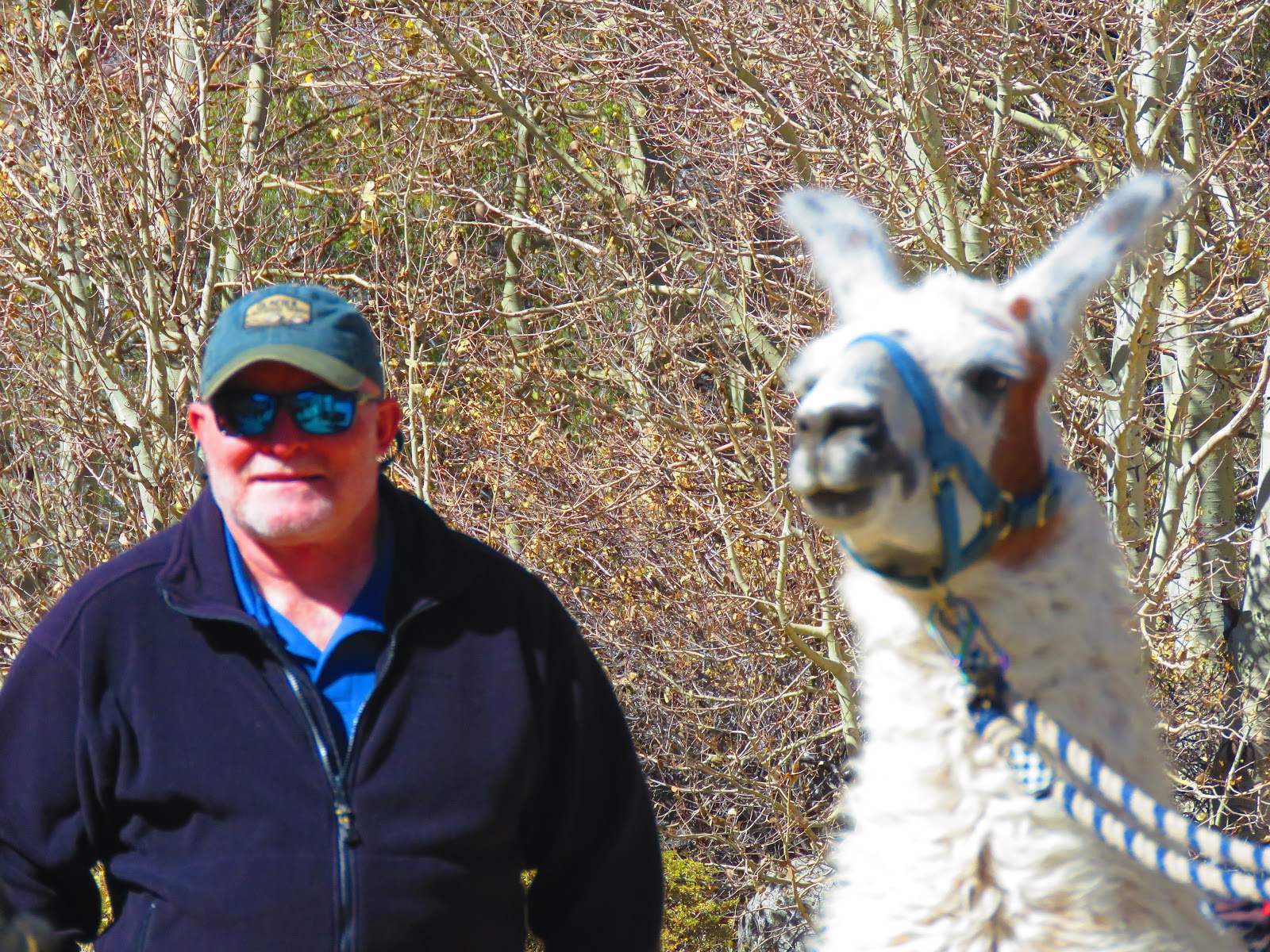
As we continued
down the mountain, we noticed a woman on a roadside pull-out with three Lamas
and two dogs. We pulled over and asked if we could take photos. She agreed if
we didn’t photograph her. Too bad, because she was a very interesting character
with strong political views and dressed in layers of colorful scarves and
jewelry like someone from Peru. We got the impression she lived a nomadic life
and had in fact been to Peru. She planned to take the three Lamas and dogs on a
hike. We got to pet the Lamas and Mike got his dog pets too!


McGee Creek Canyon Hike
The Lama lady told
us about McGee Creek Canyon. We still had time before the sun set, so we headed
north, drove down a dirt road. We hiked partially up the canyon trail into the
sun that would set behind the mountain peaks ahead. Colorful cottonwood, willow
and aspen trees, babbling streams and dramatic views made this hike worthwhile.
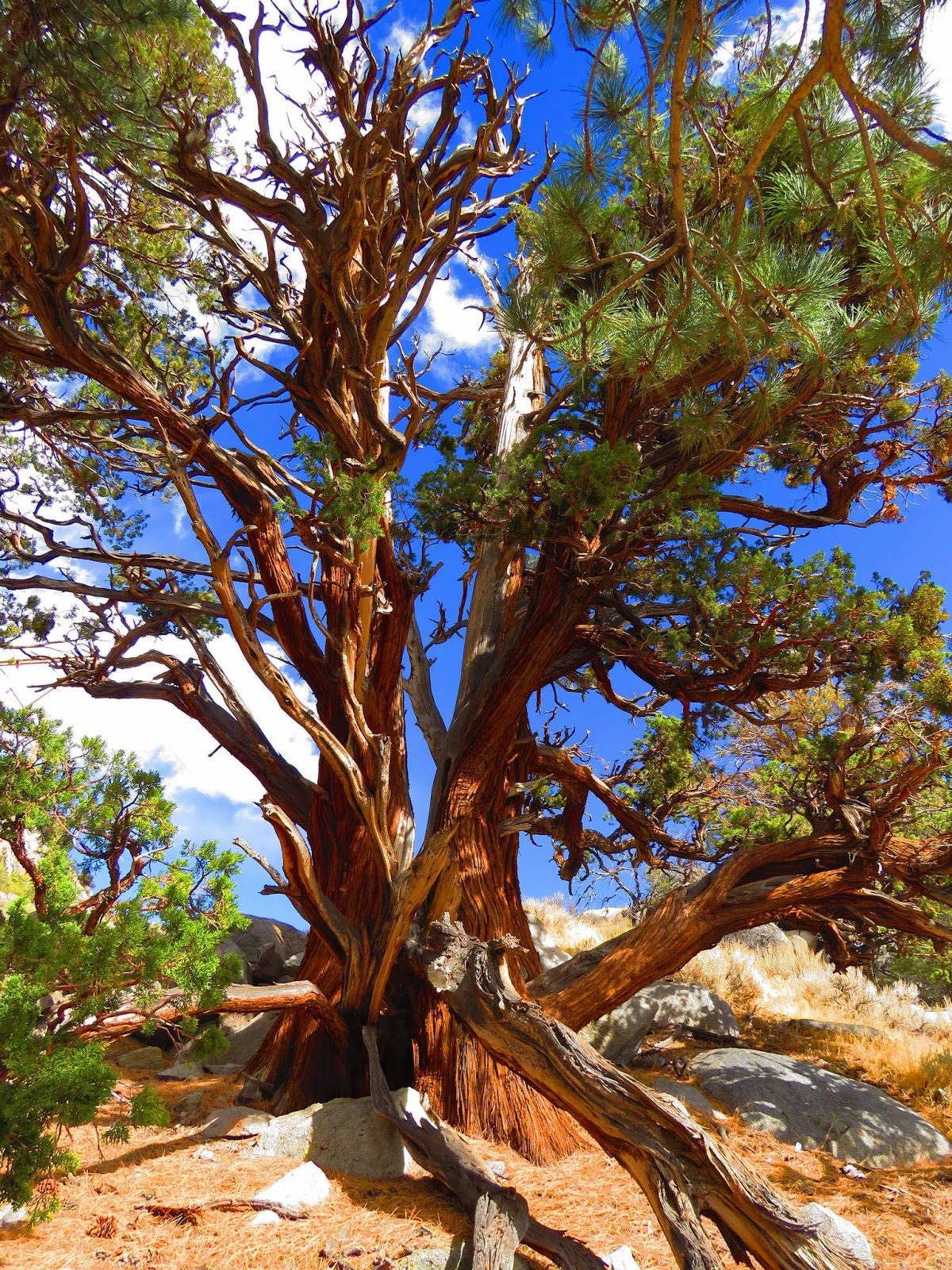
We were also surprised to see an ancient bristlecone pine on the side of the
mountain. On our way down the mountain we saw a great view of Crowley Lake, a
popular spot for camping, stream fishing, hiking and horseback riding.


We also stopped at Tom’s Place, a local landmark that was originally built in 1917. It was a seasonal café, bar, gas station, pack station and campground until 1923 when it was purchased by a man named Tom. Even after his death the new owners kept the name of Tom’s Place.

Scenic Drive to Historic Benton
One day we took a road-less-traveled
to see the historic living ghost town of Benton. In the 1800s, Benton was once
a thriving silver mining town with 5,000 inhabitants and a Wells Fargo
stagecoach stop. Benton is now a secluded vacation getaway for those who love
hot springs and night skies thick with stars. We strolled through town to see
some of the historic buildings and ate lunch at the Benton Station Café &
Gas Station.


We drove on graded dirt roads along Fish Slough and Owens Valley to Benton. The route took us through the Volcanic Tableland with slough marshes and shade pockets of willows and cottonwoods. We stopped at several red rock petroglyphs with images of hunters, animals, paw, hand and foot prints, as well as suns, dots, masks and geometric forms. This art form reflects the passage of early travelers, most recently the Owens Valley Paiute Indians.


POW WOW
We attended the
Annual Pow Wow & California Native American Day Celebration. It drew Native
Americans from various tribes around the country to compete in various dances,
some just old enough to walk. The main categories were traditional and “fancy”
dancers. It was a fun cultural experience with music, dancing and authentic
Native American food!


Our favorite were the women jingle dress dancers. Their dresses were festooned with hundreds of bells that jingled as they danced. These were originally made by rolling the tin lids for snuff and tobacco cans into bell shapes. In addition to the dancers, men formed drum teams and competed. Groups of six to eight men sat around a huge drum, beating a cadence and singing for the dancers.


Always on the
lookout for unusual foods, Mike had to try some traditional acorn porridge. If
you ever have a chance to try this, don’t!!


Owens Lake
The construction
of dust mitigation features on Owens Lake have created incredibly productive
habit for birds and other wildlife. In the spring and fall, tens of thousands
of shorebirds, waterfowl, and other migratory bird species stop-over to rest
and feed on alkali flies, brine shrimp, and other invertebrates in the shallow
flooding dust control areas and natural springs around the lake. During our
winter visit there were fewer numbers of birds. But we did see the American
Avocet, Killdeer, Long-billed Curlew, and a few other shorebirds.


Bridgeport & Twin Lakes
One day we took a
drive north, past Mono Lake to the little town of Bridgeport. The main relic
was the Bridgeport Courthouse, completed on April 1, 1881. The imposing
courthouse on Bridgeport’s Main Street is California’s second oldest courthouse
in the state to be in continual operation. Its Victorian architecture is in
keeping with the New England-esque buildings of Bridgeport at that time.


We also stopped to eat lunch at the Bridgeport Inn. It was built in 1877. Weary travelers in the Old West used this historic hotel as a stage and buggy stop to and from the Bodie Gold Mining town. Legend has it that Samuel Clemens was a guest here and a bedroom has been so named the “Mark Twain Room.” Legend also has it that the hotel is haunted by the “White Lady” who has been seen by various guests throughout the years!
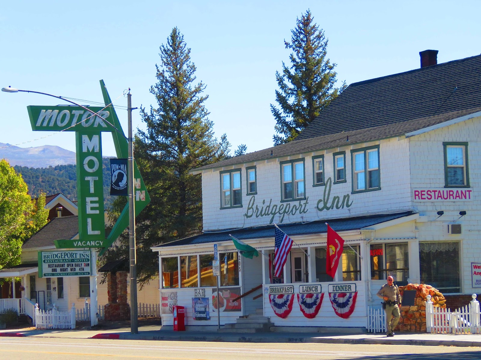
After lunch we shopped at the Eastern Sierra Trading Company where Mike bought Sharon a pair of Tommy Singer earrings, a renowned Native American jewelry artist. Since his death, the price of his jewelry has skyrocketed.

Twin Lakes Scenic Drive
We drove past
expansive ranch lands and saw a hawk and some deer before we started up the
mountain. Backed by the jagged spires of
the Sawtooth range and about 13 scenic miles from the town of Bridgeport, Twin
Lakes is truly picturesque. Bright aspens and cottonwood line both shores of
the shimmering lake.


We took a day trip
to Big Pine, a short drive south of Bishop.
We drove 12,000 feet up the White Mountains to the Ancient Bristlecone
Pine Forest. Although the pines are
found in six western states, the Schulman Grove and Patriarch Grove are home to
the oldest known trees on Earth. Some of these trees are over 4,000 years old
and still growing strong. Since the wood
here in the cold, dry environment of the White Mountains decomposes very
slowly, tree-ring patterns remain intact for thousands of years.
Schulman Grove
Dendrochronology is defined as the science of studying tree-ring patterns. Andrew Ellicott Douglass (1867-1962) has been referred to as the founder of modern dendrochronology. Dr. Edmund Schulman (1908-1958) was one of the scientists’ instrumental in extending the long continuous tree-ring chronology and the advancement of the science of dendrochronology.
Dendrochronology is defined as the science of studying tree-ring patterns. Andrew Ellicott Douglass (1867-1962) has been referred to as the founder of modern dendrochronology. Dr. Edmund Schulman (1908-1958) was one of the scientists’ instrumental in extending the long continuous tree-ring chronology and the advancement of the science of dendrochronology.
At the visitor center there are three trails to hike and see the Schulman Grove. Take your hiking poles! The Methuselah Trail was a 4.5-mile loop. The Bristlecone Cabin Trail was a 2-mile loop. We took the Discover Trail which was a 1-mile loop. Even though it was only 1 mile, the elevation is what gets to these flatlanders!


After our hike to Schulman Grove, we stopped at the Visitor Center to eat lunch. Our visitors wanted some too!


Patriarch Grove


Lone Pine, CA
The town of Lone
Pine was founded during the 1860s to provide supplies to the local gold and
silver mining communities. Lone Pine was a focal point for Native American life
for over 10,000 years. The area is known for its bizarre rock formations, home
to miners, and a backdrop for the Hollywood filming industry for movies,
commercials and TV shows in the Alabama Hills beginning in the 1920s and
continuing today.


Museum of Western Film History
We spent hours in
the museum with 10,500 square feet of exhibits, an eighty-five-seat movie
theater and gift shop. The museum documents and interprets the cultural
heritage of Western cinematic film history. For over 100 years the Hollywood
studios have found the Sierra Nevada Mountains and the rugged Alabama Hills the
perfect “back lot” for making films. The region has provided a palette for film-makers
as landscapes for TV Westerns, major Sci-fi and action films; and a fill-in for
India, China and other Eastern locations.


Tom Mix, Roy and Dale, Gene Autry, Hoppy, Randolph Scott and the “Duke” are but a few great western film and TV series heroes that are honored in the exhibits through photos, costumes, props, scrips and priceless movie posters. Contemporary actors including William Shatner, Kevin Bacon and Robert Downey, Jr. have all filmed in the shadow of Mount Whitney in such films as Star Trek, Tremors and Iron Man.
Hike to
Mobius Arch
We drove along
Movie Road in the Alabama Hills with sites where many movies were filmed. It
all began in 1920 when Fatty Arbuckle came here to film The Round Up for
Paramount. Since then, more than 300 feature films have been shot in the
Alabama Hills, along with dozens of TV shows, movie serials and car
commercials.

The Alabama Hills were formed by a process called uplifting and chemical erosion with rounded stone monuments which are a sharp contrast to the massive granite peaks chiseled by glaciers of the Sierra Nevada. After Yosemite, the Alabama Hills was one of Ansel Adams’ favorite shooting locations. And a popular spot for rock climbers.


There are over 100 stone arches scattered through the area, the largest of which is the Mobius Arch. In the distance, Mount Whitney, at 14,505 feet tall, is the highest point in the contiguous United State. We hiked on a 1.5-mile loop trail that took us to the iconic photo-op of Mount Whitney through Mobius Arch. Somehow, we missed the return loop and continued on another trail. When we reached the end of the trail we could see our Jeep, but would have to turn back and find the loop trail to return to the Jeep!


Independence,
CA
Mt.
Whitney Fish Hatchery
We arrived at the
Mt. Whitney Fish Hatchery and the building was closed, so we walked the
property. Mike fed the ducks and trout
in the pond, but it was out of season, so we did not see the fish hatchery.


The architecture was not one you would expect for a fish hatchery! Construction of the hatchery began in March of 1916 and is constructed of native granite collected within a quarter of a mile of the site. The walls are two to three feet thick. None of the stones used in construction were cut, but were “sorted to fit.” The roof is red Spanish tile made in Lincoln, California from red clay found at that location. The interior is finished with Oregon ash. The grounds of the hatchery were landscaped by a gardener brought in from Golden Gate Park in San Francisco. Approximately 3,500 tons of boulders used in the walls were guaranteed not to “crumble until the mountains shall fall.”


The first trout hatched in 1917 were from eggs collected at Rae Lakes. The eggs were transported from the collecting station at Rae Lakes via Baxter Pass by mule train to the hatchery. The spawning season of 1918 saw the first collection of golden trout eggs from the Cottonwood Lakes. This program continues to this day and has provided golden trout for planting throughout the Sierra Nevada. The golden trout is the California state fish.
Eastern
California Museum
The Eastern
California Museum was founded in 1928. The museum’s collections and exhibits
reflect the diverse natural and cultural heritage and history of Inyo County,
the Owens Valley, and the Eastern Sierra backcountry, from Mono Lake to Death
Valley.


There is a large collection of photographs (more than 25,000 prints) that provide a glimpse into the history, the people, the culture, and the activities and events that formed the fabric of life in the Eastern Sierra and the Owens Valley. Famed mountaineer Norman Clyde’s photo collection is a testament to the tenacity he showed when completing more than 100 first ascents in the Eastern Sierra, and highlights his ability to capture the beauty of the mountains he first roamed.


The museum tells the history of building the Los Angeles Aquaduct from 1913-2013.


Manzanar
Japanese Internment Camp
We visited the actual site of the Manzanar Japanese Internment Camp and interpretive center. The interpretive center features extensive exhibits and audio-visual programs. A 3.2-mile self-guided driving tour circles the site. For decades before
World War II, politicians, newspapers, and labor leaders fueled Anti-Asian
sentiment in the western United States. Laws prevented immigrants from becoming
citizens or owning land. Immigrants’ children were born US citizens, yet they
too faced prejudice. Japan’s December 7, 1941 attack on Pearl Harbor
intensified hostilities toward people of Japanese ancestry.


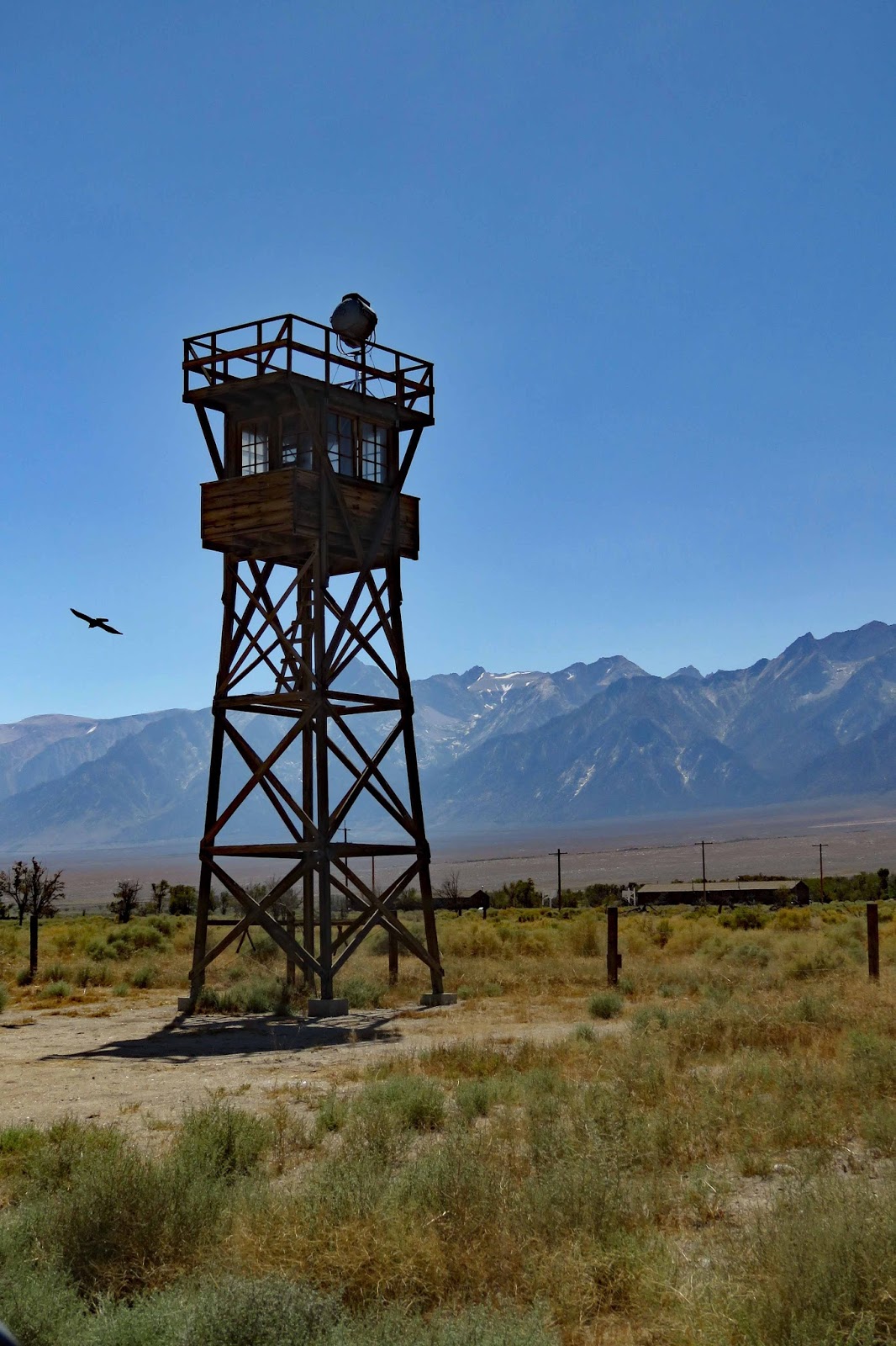


Among the hardships of Manzanar, the wind and dust storms were some of the most unforgiving and unforgettable.


People built gardens to beautify the dusty ground outside their barracks.


After the war, the government removed most of the structures, and buried gardens and basements. As time passed, Manzanar was further buried, both in sand and in memory. Although nothing remains, when you look at the barren landscape, the place comes to life. A pipe sticking out of the ground becomes a water faucet where children splashed their faces in the summer heat. A foundation reveals the shoe prints of a child who crossed the west cement. Ten iron rings embedded in a concrete slab evoke the humiliation of ten women forced to sit exposed next to strangers, enduring private moments on public toilets.

A cemetery monument was built in 1943. Today, the monument is a focal point of the annual pilgrimage, serving as a symbol of solace and hope.


The story of Manzanar is riveting and disturbing. It depicts the struggles reflected in the injustices that over 10,000 Japanese Americans faced here. The camp closed on November 21, 1945, three months after the war ended. In the 1980s, a congressionally authorized commission concluded “race prejudice, war hysteria and a failure of political leadership” led to the incarceration of Japanese Americans during World War II. It recommended a presidential apology and individual payments of $20,000. The US government issued over 82,000 apology letters and redress payments to Japanese Americans in order of age, oldest to youngest, between 1990 and 1999.


Burro Schmidt Tunnel
The historic Burro Schmidt Tunnel is in the El Paso Mountains of the northern Mojave Desert. It was hard to believe that prospector William “Burro” Schmidt spent over 30 years hand-digging this 1/2-mile-long tunnel in the middle of nowhere. It took us a while to find the right dirt road to get us to the location.
The historic Burro Schmidt Tunnel is in the El Paso Mountains of the northern Mojave Desert. It was hard to believe that prospector William “Burro” Schmidt spent over 30 years hand-digging this 1/2-mile-long tunnel in the middle of nowhere. It took us a while to find the right dirt road to get us to the location.


After exploring the outside of his vandalized cabin and abandoned caretaker’s house we turned a corner where there must have been a bee’s nest! Too many bees prevented us from going inside of the cabin, but we had read that a giant collage of newspaper headlines, advertising pictures, and tea bag labels covered the walls. They had all been secured to the wall with small nails and handmade cardboard washers.


As we hurried past the bees, we continued to hike up and down hills to find the tunnel. After many failed attempts, Sharon finally found it! It was too dark, even with a flashlight, to venture through the tunnel to the other side!


Schmidt was a loner prospector living a hard life in Last Chance Canyon. He spent thirty-two years single-handedly drilling a tunnel nearly a half-mile long through solid granite with a pick, a four-pound hammer and a hand drill. He needed to create a short cut to bring his gold ore to market. He continued this tedious, grueling effort day in and day out. The broken rock he would carry out, first on his back in canvas bags, then later by wheelbarrow and finally with a mine car on iron tracks he installed. There is no record that there ever was a true gold strike, although the legend continues. Soon after he broke through to daylight on Copper Mountain, he walked away, deeding his mine/tunnel to a fellow miner.
Fossil
Falls
We saw a sign and
drove to Fossil Falls. It was a nice hike through rock formations. There were
no fossils or falls! It was a spectacular lava flow sculpted by rushing water
and wind late in the Ice Ages. The Owens River no longer flows here so the
falls are dry, dropping forty feet into the ancient river channel. Near the top
of the falls you can find where the swirling water tumbled rocks around to form
smooth round holes. As we explored, we imagined hearing the waterfall flowing
over the rocks to the gorge below.


On the way back home we stopped to see some neat old stone buildings.


Mono Lake Tufa State Natural Reserve
“A country
of wonderful contrasts, hot deserts bordered by snow-laden mountains, cinders
and ashes scattered on glacier-polished pavement, frost and fire working
together in the making of beauty.” John Muir
One of the oldest
lakes -- at least 760,000 years old -- in the western hemisphere, Mono Lake is
hauntingly beautiful. It has no outlet. The salinity content is over twice that
of the ocean, therefore, no fish can live in the lake. The lake’s most
distinctive feature is its eerie tufa towers – mineral structures created when
fresh-water springs bubble up through the lake’s alkaline waters. This ancient
sea plays host to millions of migrating birds that come to feed on its teeming
populations of alkali flies and tiny brine shrimp. We hiked to the shore of the lake. The views were spectacular.


We took a short drive
to the South Tufa Area and hiked the nature trail to the lakeshore. These tufas were very interesting in their formations.


Panum Crater
We ate a picnic
lunch before continuing to the Panum Crater trailhead that would take us on a
hike to the dome and rim of the youngest of the Mono Craters. Panum Crater erupted only 650 years ago. This
volcano exhibits all the characteristics of the textbook rhyolitic, plug-dome
volcano. A product of this volcanic
eruption is obsidian, the volcanic glass that Native Americans used to make
arrow points and scrapers.


Mono County Park
We drove to the other side of Mono Lake to Mono County Park and hiked along a boardwalk to the water.


Sunset and Moonrise at Mono Lake
We scouted out a
place to photograph the sunset and moonrise. We were dressed warm for the cold
that would take over when it got dark. We hiked over a boardwalk which ended,
and we continued in the muddy grass until we reached the lakeshore. Sharon set
up her tripod on some rocks. Her camera was already set with the recommended
ISO, F-stop, and aperture to capture the moonrise. We shared our space with another couple who
came over from Los Angeles to photograph the full moon.


Mammoth
Lakes
We stopped at the
Mammoth Lakes Visitor Center before driving through the Ansel Adams Wilderness
and John Muir Wilderness to the trailhead for Devils Postpile and Rainbow
Falls. Along the way we stopped at the Minaret Vista at an elevation of 9,175
feet. The Minarets are all that remain of an ancient lava flow.


Devils Postpile National Monument
Formed 100,000
years ago, this is one of the world’s finest examples of columnar basalt,
stretching 60 feet high, and it’s a short, easy half-mile hike from the
trailhead.


Mike took the steep hike up to the top of the postpile revealing the top of the columns which looked like the pavers people use for their patios. Column tops were polished by past glaciers.


Rainbow Falls
We continued our
hike for another few miles from the Devils Postpile to Rainbow Falls. The falls is located where the San Joaquin
River tumbles over an abrupt 101-foot lava ledge, almost always graced with a
rainbow. And when we arrived, we did in fact see the rainbow! One site we had never seen before is a hiker
carrying his dog in his backpack!


Our return 2.5-mile hike back to the ranger station and Jeep.


On the way home we stopped at Convict Lake to see if it would be a good lake to kayak on. Convict Lake got its name from an incident in 1871, when inmates from a Nevada prison escaped here and battled their way out with a shootout.
June Lake
Loop & Hike on Rush Creek Trail
We ate lunch in
the picturesque village of June Lake. It’s a mountain hide-a-way with a scenic
16-mile scenic loop drive through the spectacular scenery of Glacier-carved
Horseshoe Canyon. The loop’s four glistening lakes are renowned for fishing,
and are stocked with trophy-size trout. Gulf Lake is followed by Silver Lake
and Grant Lake.


We stopped at Silver Lake and took a hike on the Rush Creek Trail.


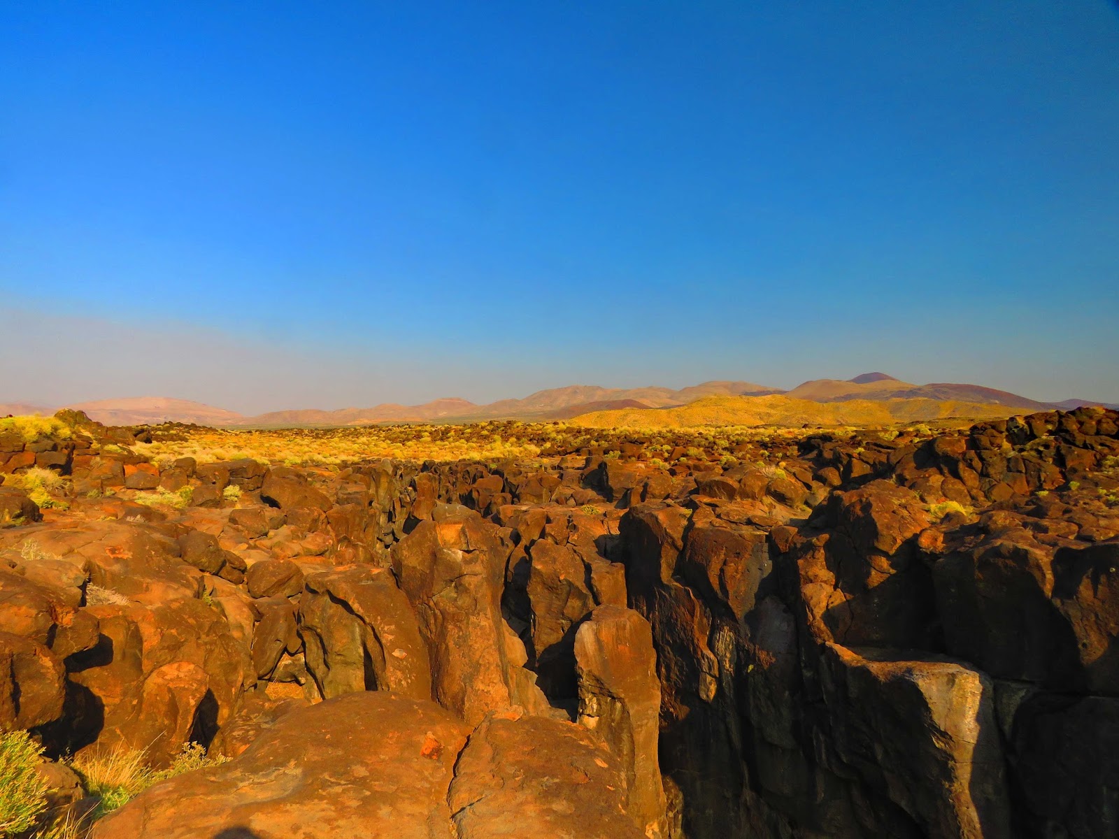
Red Rock Canyon State Park
This park was in a
remote area off Highway 14 and south of Bishop. It was established as a state
park in 1968. We hiked along the unique and colorful canyons and cliffs. These
fluted folds are the result of wind and rain eroding the softer materials
beneath and dark caprocks, which were formed by a harder lava flow layer.


Death Valley
Death Valley
National Park was about a three-hour drive from Bishop. We decided to spend
three days there, so we drove down 2 days and spent one night in the park’s
Oasis at Death Valley so we could get up early to go on a hike before it got
too hot. On our last day the temperature in Death Valley reached 105 degrees! It’s the hottest, driest and
lowest – this is the land of extremes. We were amazed at the strikingly
beautiful environment. Our first stop was the Furnace Creek Visitor Center.


The lowest point in the country at 282 feet below sea level, Death Valley frequently boasts the hottest temperatures as well. With over three million acres of designated wilderness, we explored almost all the amazing sites in three full days. Wild burros roamed the park and are descendants of animals turned loose by prospectors.


The Shoshone word for Death Valley and the red rocks and surrounding mountains is “Timbisha” meaning rock paint, coming from the red ochre paint they made from clay. Few people realize that an American Indian tribe currently lives and thrives in Death Valley. For thousands of years, the Timbisha Shoshone have resided in Southeast California and Southwest Nevada. In 1936, the tribe established a tribal center on a 40-acre tract at Furnace Creek. The tribe achieved federal recognition in 1983 as the Death Valley Timbisha Shoshone Band of California. In 2000 the Timbisha Shoshone Homeland Act transferred over 7,000 acres of trust lands to the tribe both in the park and adjacent to its acreage.


We rushed to see
the sunset in Golden Canyon at Artist’s Palate. Artist’s drive is a dipping,
diving, curving, one-way road that weaves through striking ravines and colorful
rock formations. It is a visual feast and a geologic tour of one of Death Valley’s
most explosive volcanic periods. We stopped and hiked up a hill to what we
thought was Artist’s Palate. We stayed to watch part of the sunset until we realized
this was not Artist’s Palate!


The highlight of the nine-mile loop occurs at the Artist’s Palate, so we drove until we saw the sign for Artist’s Palate. Splashed against the barren background like brilliant dabs of paint from a giant’s brush were mineral deposits of sea green, lemon yellow, periwinkle blue and salmon pink. The colors changed rapidly during the setting sun. It was beautiful!


Badwater Basin
Badwater Basin is
at 282 feet below sea level. It is the lowest point in North America. With the
Black Mountains in the background, we strolled through a shimmering expanse of
nearly pure white table salt.


Wildrose
Charcoal Kilns
You would never
imagine that these kilns have stood in Death Valley since 1877. On our way down the dirt road, we were surprised to see a picnic spot so we stopped.


We marveled at the beehive-shaped kilns at the Wildrose Charcoal Kilns that were erected by the Modock Consolidated Mining Company in 1877. The well-preserved kilns – each standing about 25 feet high with a diameter of approximately 30 feet across – were used to convert pinyon and juniper logs to charcoal for two silver mines located 25 miles away. Each kiln held 42 cords of pinyon pine logs and, after burning for a week, would produce 2,000 bushels of charcoal. The Wildrose Charcoal Kilns are considered to be the best surviving examples of charcoal kilns found in the western states. The kilns were golden in color.


Mike wandered behind the kilns to an old foundation of an out building. To his surprise, be came upon a rattlesnake. Mike yelled out to Sharon “come quick!” She got there just in time to see the rattlesnake slither underneath a bush. You could tell by the size of its rattle that it was a big snake! Curious Mike had to find the snake which climbed into a hole in the rocks. By now it was coiled with its tail rattling and his head and eyes fixed on us. Mike encouraged Sharon to take a close-up photo of the snake. Her adrenaline pumping, Sharon nervously got close enough to get a photo, hoping the rattlesnake would not strike! The things we do for love!!


Dante’s View
Dante’s View is
more than 5,000 feet above the valley floor. The view is spectacular. At this
high altitude in the dry desert air you can see across most of 110-mile-long
Death Valley. You could see people walking in the white salt flats far below at Badwater Basin.


Moonlight at The Oasis at Death Valley
We spent a night
at The Oasis at Death Valley, known as Furnace Creek Camp in the mining days. It was nice to stay in the park instead of
driving back to Bishop.


Death Valley is an International Dark Sky Park, so after the sun set we took a short drive to an area away from the camp. It was totally dark with an occasional car driving by. Sharon had her camera set up to shoot the full moon and its reflection on a small pond.

The Furnace Creek Inn was under renovations. It was first opened for business in 1927 for wealthy visitors accustomed to a luxury hotel.

Hike to Darwin Falls
The park warns
that you should not hike in low elevations after 10:00 a.m. to avoid the
extreme heat. We got up early, packed a
lunch, filled up our coffee mugs and found the unmarked gravel access road to
the trailhead to Darwin Falls. It was a challenging hike that started in a
gravel-bottomed arroyo that curves toward the mouth of the canyon. Darwin Creek
supplies water to nearby Panamint Springs Resort via the pipeline we saw along
the canyon.


There is no maintained trail so we continued along the canyon until we came to clusters of willows that draped the stream. We crossed the stream several times, climbed over boulders until we reached the lush oasis at Darwin Falls. The cascade tumbles through a narrow, frothy chute, splitting at the bottom as it slides down either side of a mossy boulder in a twenty-five-foot drop. A deep pool spreads out in front of the falls. There was a cave to the left of the waterfall where we saw bats come and go. Among the cattails, watercress and ferns we a red spotted toad!


After the hike we drove out to the main highway to a place where coyotes were known to frequent. We were fortunate to see a mother watching over her two pups!


Devil’s Golf Course
The floor of Death
Valley is a vast evaporating dish covering more than 200 square miles. It is
crusted over with a variety of salts, and nowhere is this more apparent than at
Devil’s Golf Course. Gnarled crystalline salt spires dot the landscape and look
like a coral reef run amuck. The lump salt pinnacles are the residue of Death
Valley’s last significant lake, which evaporated 2,000 years ago.


Father Crowley Vista Point
A landscape of
dark lava flows and volcanic cinders abruptly gives way to the gash of Rainbow
Canyon below this viewpoint. Father John J. Crowley (1891-1940) was the Padre
of the Desert. From the snowy heights of the Sierras beyond the deep shadows of
Death Valley, he was beloved and trusted by people of all faiths.


Natural Bridge
This was a 2-mile
round-trip hike through a dramatic canyon to a natural bridge formation. We
felt very small below the natural bridge. Along the way Mike discovered a dead
Raven which have been known to drop dead from the extreme heat!


Harmony Borax Works Trail
We wanted to see
where the famed 20-mule team wagons hauled borax, so we walked the interpretive
trail at Harmony Borax Works, a mining operation that dates back more than 120
years. After prospectors found borax in 1881, William Tell Coleman built the
Harmony plant and began to process ore in late 1883 or early 1884. The plant
employed 40 men who produced three tons of borax daily. The 20-mule teams
hauled borax 165 miles to the railroad town of Mojave. The teams averaged two
miles an hour and required about 30 days to complete a round-trip. It was
interesting to see the rusting remains of buildings, machinery, tanks and
piping and the old wagon!


Of the many ghost
towns in Death Valley, we visited Rhyolite, the largest ghost town. Rhyolite
boasted a population of nearly 10,000 people during its peak between 1905-1911.
At its height, the town contained two churches, 50 saloons, 18 stores, two undertakers,
19 lodging houses, eight doctors, two dentists, a stock exchange and an opera.


Sharon’s favorites were the remains of the three-story bank building, the jail and the Bottle House made from beer and liquor bottles. Over thirty thousand bottles were used. The Bottle House was restored by Paramount Pictures to use as a movie setting in 1925.


On our way out of this ghost town, we stopped at the surreal Goldwell Open Air Museum. The Museum began in 1984 as a project of Belgian sculptor Albert Szukalski, best known for his haunting life-size shrouded figures. The piece that launched the museum is The Last Supper. To create the ghostly figures, Szukalski wrapped live models in fabric soaked in wet plaster and posed them.


Ballarat Ghost Town
We drove out to
Ballarat Ghost Town, an old camp from the turn of the 20th century
that served nearby mining camps from 1897- 1917. It once had seven saloons and three hotels.
Today, there is just a caretaker to watch over the few remaining structures. While
Mike talked with the crusty caretaker and got us a cold drink, Sharon enjoyed
taking photos, one of the old truck owned by Charles Manson, who was known to
hang out here in the desert. There were stars painted on the headliner of his truck.


Mesquite Flat Dunes
We always liked
the colors and contours of sand dunes. The Mesquite Flat Dunes were beautiful.
Sharon likes to photograph the ripples and footprints in the sand and the
shadows during sunrise or sunset. These 150-foot dunes are nearly surrounded by
mountains on all sides. The tiny grains of quartz and feldspar that make up the
dune field began as much larger pieces of solid rock, but through erosion,
became sand-sized.


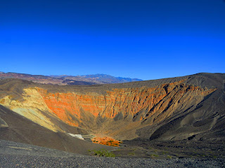
We didn’t have any
intention of hiking down into the 770-foot-deep steam-explosion crater as the
climb out would have been grueling! So, we stood in awe at the rim of Ubehebe
Crater and imagined the instant when water suddenly flashed to steam –
shattering the rock above and ejecting a cloud of debris at speeds of up to 100
miles per hour!


Zabriskie
Point overlooking Twenty Mule Team Canyon
One of Death
Valley’s most popular lookouts is at Zabriskie Point. Once you reach the top of
the mountain, a short uphill hike takes you to a panoramic view of Death
Valley’s wildly eroded and vibrantly colored badlands.


Scotty’s Castle

There were two sites we were unable to see in Death Valley. Scotty’s Castle was closed due to the road being washed out by flash floods in 2015. The castle is more like a European villa, built in the Spanish Provincial mode. The castle was the idea of the legendary prospector Walter Scott known as Death Valley Scotty, who in his youth, worked in Buffalo Bill’s Wild West Show. The 2.5 million dollars it took to build the castle is rumored to have come from a secret gold mine, but it appears that a business man from Chicago, Albert M. Johnson, really owned and financed the project.
Racetrack Playa
The other site we
were unable to see was the famed Racetrack Playa where the giant rocks
mysteriously slide across the dried flat lakebed. The dirt road was too rough
for the jeep! We were always curious about the rocks and disappointed we were
unable to see them. All size of rocks slide across the desert floor, leaving a
long visible trail in the muddy clay. The most reasonable scientific
explanation is that the clay surface is filled with ice crystals, and the
frequent 70 to 90 mph winds move the rocks over the playa. The rocks only move
under perfect conditions, which can be a rare event! Maybe next time!

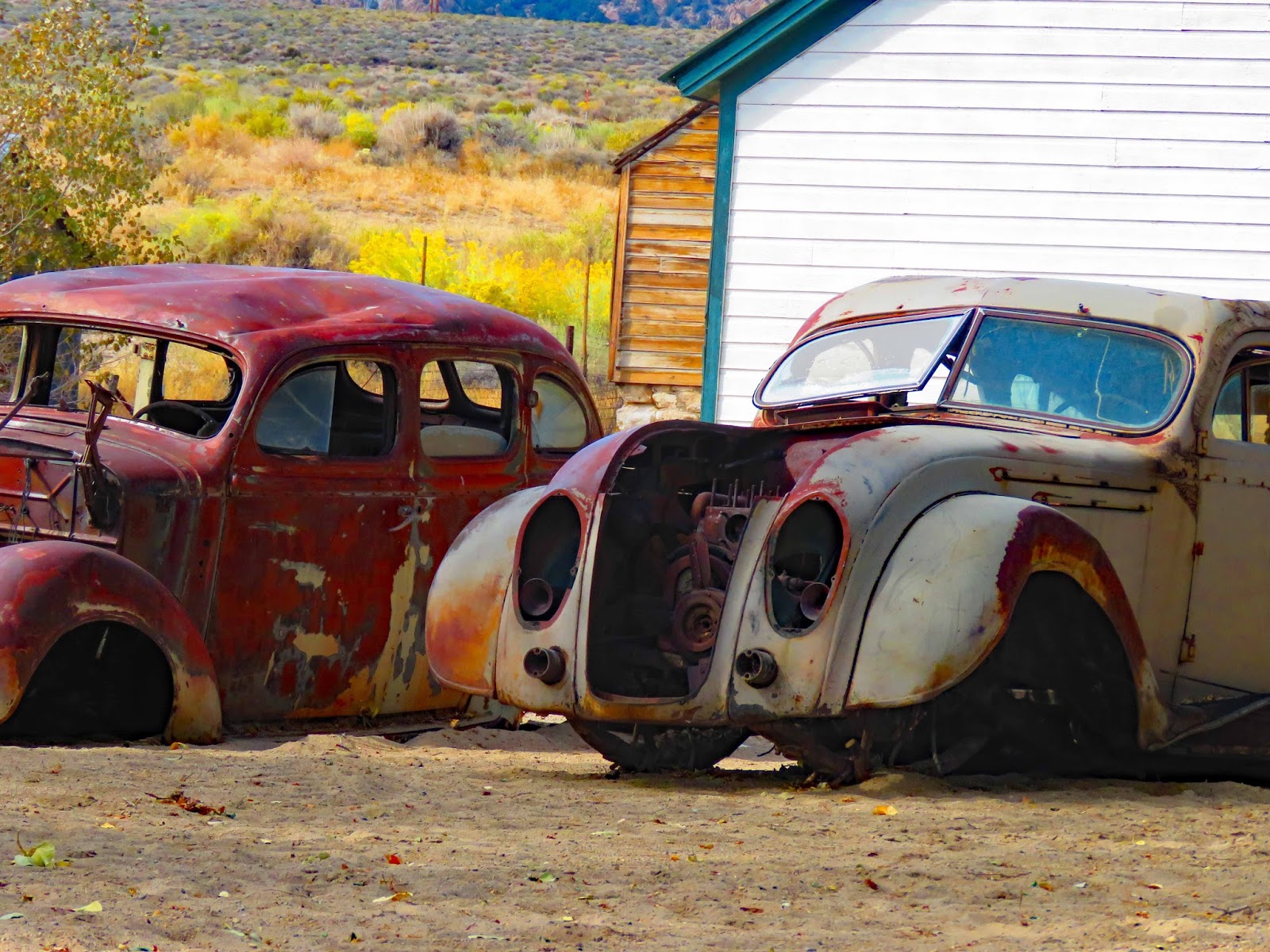
As we drove around Death Valley we kept seeing these cars covered with black and white camo wraps. We found out they were prototypes and the wraps were designed to make it hard for a camera lens to focus on them. We found this photo on-line.

Our next stops this winter will be San Diego, Pala and Palm Desert in California. We’ll spend February through May in Gold Canyon, AZ where we’ll fly home to Sarasota for our annual visit. Have a healthy, prosperous and adventurous New Year!
Mike & Sharon
“Adventure
is worthwhile”
Amelia Earhart