NOTE: Best to view blog on computer, however to
view full blog on phone scroll to bottom of the blog and click on “View Web
Version”. Be sure to click on the RV Schedule tab at the top of the page in the
menu bar to see where we will be. You can also enlarge the google map in the
sidebar on the right and click on the markers to view where we have been. If
you want to meet up with us, see the RV Schedule and let us know so we can
spend some time with you!
Whaleshead
Beach Resort, Brookings, OR
On the way to
Brookings from Portland, we spent one night at the Elkton RV Park in Elkton. It
was on the Umpqua River with lots of smooth rocks you could walk on. It was a nice stop
over.


On September 6,
2015 we arrived at the Whaleshead Beach Resort just north of the little coastal town of Brookings,
Oregon. It was Labor Day so Mike had the flag out! We stayed for a week.

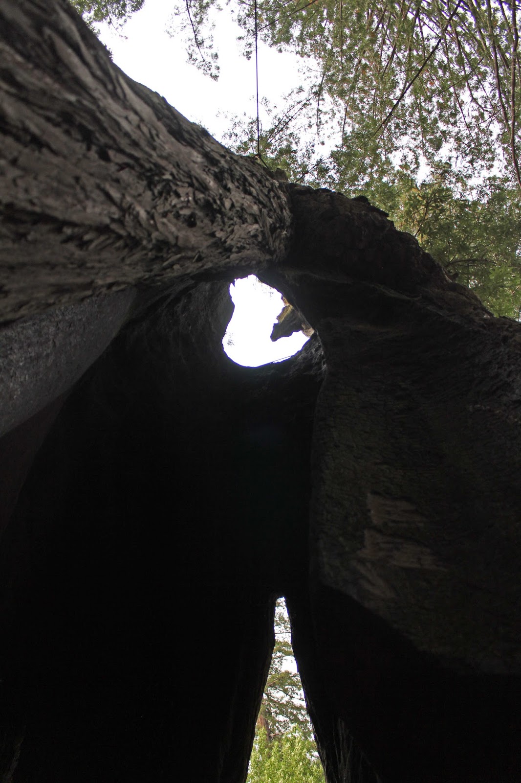
Across the road was access to Whaleshead Beach. Offshore, within walking distance of the beach at low tide, lies the “sea stack” that looks like the head of a whale. The giant sea stack is channeled with caves that give the appearance of a whale spout whenever struck by a wave earning the sea stack its characteristic name. During the whale migrations, the sea beyond Whaleshead becomes a corridor for migrating grey whales (up to 46 feet long). We walked down to the beach after we set up the RV and watched the awsome sunset!


Often touted as Oregon’s Banana Belt, Brookings has weather patterns that deliver some of the warmer temperatures along the Oregon Coast. This pleasant climate has been a catalyst for the rebirth of Brookings as a center for the nursery industry. Nearly all of the lilies marketed in the U.S. are cultivated in the Brookings area. It’s also known for the annual Azalea Festival, the Southern Oregon Kite Festival and monthly art walks.
Samuel
Boardman State Park Scenic Drive
One day we decided
to drive along the 12 miles of rugged coastline named the Samuel H. Boardman
State Scenic Corridor. The drive featured one scenic viewpoint after another. At some of the overlooks, we decided to take our hiking poles to get down to the beach to see the offshore
sea stacks, including the dramatic Arch Rock.
Whaleshead Point
Our first stop was Whaleshead Point. The overlook was spectacular so we decided to hike down the trail to the beach.


Lone Ranch Viewpoint


Sharon scattering ashes of her brother, John.


Arch Rock Viewpoint


Natural Bridges Viewpoint


We returned to Whaleshead Beach at the end of the day for another sunset.


Port Orford
Despite its
natural beauty and quirky personality, Port Orford is one of the South Coast’s
undiscovered gems. With a population of only 1,128 there are no crowds. It has
an active and talented art community with ten galleries and monthly music and
poetry events.


One of Port Orford’s
most unique features is its dolly dock, one of only two in the U.S. Since the town’s open-water harbor isn’t
protected from sea swells, boats in the commercial fishing fleet are hoisted in
and out of the harbor by a huge crane each day!

We stopped at The
Wooden Nickel to find a handcrafted piece of myrtlewood
which is a unique
broadleaf evergreen of the laurel family. It is a hardwood of very fine texture
with a variety of grain patterns such as burl and swirls. Striking and
unexpected colors vary from light tan to deep golden brown, on to shades of
grey and almost black with various hues of the rainbow often intermingled. The
myrtle tree is also unique in that it grows only in a very limited geographic
area, generally from Coos Bay, Oregon to San Francisco, California. We selected
a nice cheese board made of this exotic wood!

Just north of town
we went to Cape Blanco State Park, the absolute westernmost point with
spectacular views. This park bears the
brunt of winter storms where gusts of winds have been measured as high as 184
miles per hour.


Bandon
We drove north of
Brookings up to a little town called Bandon located at the mouth of the
Coquille River. Just north of town
we stopped to see the Coquille River Lighthouse. It was erected in 1896 and
decommissioned in 1939. It has been restored to its original Italianate
splendor through the collaborative efforts of local residents, Oregon State
Parks and the U.S. Army Corps of Engineers.


We then drove Beach
Loop Drive to take in views of the scenic shoreline with spectacular rock
formations. We did a little rockhounding for petrified wood on Bandon Beach which stretches 3 miles south of the Coquille River. We found lots of dull gray rocks, but no petrified wood.


After our excursion on the beach, we finally arrived in Bandon and strolled along Old Town to window shop
and made our way to the waterfront boardwalk and public dock. Little did we
know that Bandon was the Cranberry Capital of the West Coast!


We stopped at the River View Gems & Gifts where they had a lot of beautiful specimens and jewelry too! We found petrified wood that was in its natural state but it was partially polished exposing its beautiful colors. It was the dull gray rocks we saw on the beach earlier, but had no idea what it looked like on the outside! We must have passed by this rock many times not realizing what it was! Sharon purchased fossilized shell pendant and an agate pendant collected from Bandon Beach.

We worked up an
appetite and so we ate where the locals ate at Tony’s Crab Shack where Mike
enjoyed some delicious Dungeness crab legs and Sharon had a huge filet of Pacific
Halibut.


Just outside of
town is Coquille Point which overlooks a series of offshore rocks that provide
habitat for harbor seals and thousands of seabirds. We were awed by the roar of the seals, the
call of the seabirds and the sound of the crashing waves pummeling against the
rocks.


We then drove to Bullards
Beach. By now, it was actually pretty
cold, windy and foggy out.


Coos Bay
Coos Bay was named
for the Coos tribe who occupied more than 700,000 acres along the Southern
Oregon Pacific Coast. Most tribal people were hunters, fishermen, and
gatherers. Coos Bay is Oregon’s largest city on the coast and is an active port
busy with ship traffic. We did a walk about town!


Rockhounding
We found a
rockhounding spot where you could drive along the shore of the Chetco River at the Social Security Bar access
(funny name!). We hunted for quartz, jasper and agate.


We also hiked down
to Orchard Bar on the Rogue River where we found a group of kayakers. We hunted for quartz, agate, jasper and petrified wood which is what the area is known for. Mike crossed the little
waterfall to the other side while Sharon perched herself along the shore
looking for rocks! Unbeknownst to Sharon, Mike had taken a fall while crossing on
the slippery moss of the waterfall and gouged his shin pretty bad. But intent
on finding rocks he continued across the falls without alerting Sharon!! After a few months of not healing, Mike ended
up going to the walk-in clinic to get it checked out!

Another day, we hiked in the drizzle to an unknown location in the forest to rockhound. It's unknown because we just can't remember where it was!!


On another day we hiked down below the bridge to rockhound on the gravel bar of the Pistol River. Here to we hunted for quartz, agate, jasper and petrified wood which is what the area is known for.


Our 40th Anniversary in the Redwoods
When we left
Brookings, Oregon on September 13, we traveled south to Leggett, California
where we spent one night at the Redwoods River Resort. We parked alongside a
giant Redwood. It was our 40th anniversary so we had the afternoon
to explore Humboldt Redwoods State Park and the Avenue of the Giants where we
renewed our vows.

Avenue of the Giants
Humboldt
Redwoods State Park encompasses 53,000 acres, with 17,000 acres of
ancient old-growth coastal redwoods, the largest remaining contiguous
old-growth coastal redwoods in the world. The trees here are thousands of years
old and have never been logged. California’s
noble giant sequoia and the towering coast redwood are cousins. The two
spectacular trees inhabit particularly beautiful stretches of California.
They’re the staggeringly big members of the Sequoia family: the coast redwood
(Sequoia sempervirens), the tallest living thing on earth, and the giant
sequoia (Sequoia giganteum), the world’s most massive tree. Enormous, ancient,
resistant to fires and disease, coast redwood and giant sequoia trees can
survive for thousands of years.


It
was here in the Redwood Grove that we renewed our vows. It was very special until the sun started to
set and we got eaten alive by mosquitoes!


We
then stopped at a tourist trap where you could drive through a Redwood tree. We
couldn’t fit with our kayaks on top of the Jeep, so we posed for a few photos and watched
the next vehicle pull through the tree!


Sharon had found the historic Benbow Inn in Garberville where we enjoyed a nice anniversary dinner and dessert!

When
Arthur Benbow purchased the 1,288 acres from Ernest Linser in 1922, he
envisioned a ranch but it soon became apparent that ranching would not be
sufficient to meet the family's needs. Instead, the family decided to build the
resort hotel, golf course, and riding stables. Today, the hotel and golf course
are still operating but the riding stables burned down in the 1950s.

When
opened on July 17, 1926, the Inn was originally called the Hotel Benbow.
Electricity for the hotel originally came from two diesel generators until a
dam and powerhouse was completed on the South Fork of the Eel River around
1930. This was also the first source of power for the town of Garberville.

The
hotel soon became a popular destination for motoring tourists traveling up the
Redwood Highway. The combination of seclusion and elegant hospitality served as
quite an attraction for the Hollywood elite: Spencer Tracy, Clark Gable, Alan
Ladd, Charles Laughton, Joan Fontaine (who honeymooned with two different
husbands), and Basil Rathbone were all patrons of the Inn, as well as
dignitaries Eleanor Roosevelt and President Herbert Hoover. The most recent
celebrity guest was the King of Jordan.


The
Benbow family sold the hotel in 1962 and each of the four subsequent owners has
added many personal touches and improvements while preserving as much of the
original historic character as possible.
The
Benbow Inn was listed on the National Register of Historic Places in 1983. After a delicious meal, we always have room for dessert! Mike didn't like his much! LOL

We are headed to Petaluma,
California next, just north of San Francisco. Stay tuned for our next blog
post!
Mike & Sharon
"Enjoy the little things, for one day you may look back and discover they were the big things."
Author Unknown
From "Share the Hope"
Author Unknown
From "Share the Hope"