Our stay in Santa
Fe is almost coming to an end. In
October we hiked some interesting places and witnessed the aspen trees in
spectacular fall colors!
Bandelier
National Monument
On October 1 we
hiked and explored the ruins of cliff dwellings occupied by Indians over four
hundred years ago at Bandelier National Monument.

We hiked the Main
Loop Trail in Frijoles Canyon featuring the ruins of the Tyuonyi Pueblo, ancient
archeological sites and petroglyphs along the 1.2 mile trail. It is estimated that Tyuonyi Pueblo had 400
rooms but only 100 people lived there and the central plaza contained three
kivas. Access to the village was through
a single ground-level opening. Many of
the rooms were used mostly for storage of food and pens for turkeys.


Bandelier National
Monument was established in 1916, one of the National Park Service’s oldest
sites, with evidence of the Ancestral Pueblo people scattered across a
landscape of mountains, broad mesas, and steep-walled canyons in an area of over
one-mile of elevation change.

Evidence of human
activity dates back more than 10,000 years.
Frijoles Canyon lies in an area where numerous volcanic eruptions have
shaped the landscape. Other local
volcanic activity provided harder stones such as obsidian and basalt. The Ancestral Pueblo people used these
materials for tools and as trade items. These early people migrated in and out
of the area following the movement of game animals. They did not build permanent structures in
the area, and archeological finds are limited to items such as spear
points. Over time they became more
sedentary, building homes of wood and mud.
Early structures, known as pit houses, were built largely
underground. These houses have been
found along the Rio Grande, just south of Bandelier . Above-ground stone
dwellings, like the cliff dwellings along the trail, gradually replaced pit houses.


We dressed in
layers as we always do when it is chilly outside. But as we walked and as the
sun came up in the sky, Sharon soon wrapped those extra layers around her
waist. As we walked the trail, we were amazed at the number of dwellings carved
into the soft rock cliffs. Like past
inhabitants, we climbed ladders into several of the small carved caves
(cavates).


The cavates were dug out of
the cliff wall. Even though the tuff is soft, it would have been quite a task
to carve them using only stone tools. Mike
went inside some of the cavates. The
Pueblo people must have been smaller than us as Mike could not fully stand up. Most cavates had adobe stone rooms built in front of them. The lower walls of cavates were usually plastered and painted while the ceilings were soot-blackened. Smoking the ceilings hardened the volcanic tuff and made it less crumbly.

One of the ruins
we saw was on the ground in front of the cavates. The narrow beams jutting from the ceiling are
reconstructions of loom supports. Small
depressions in the floor indicate the location of anchors used to keep the
weaving straight. Traditionally
ceremonial weaving was done by men.
We spotted several
petroglyphs along the cliffs. Some
petroglyphs depict easily recognizable forms such as turkeys, dogs, an animal-like carving known as the Macaw (parrot) and
lightning. Others have less obvious meanings.
Once considered rock “art,” it is becoming apparent these drawings had
much deeper and specific meanings to the people who carved them. A black zigzag petroglyph
may represent the feathered serpent known as Awanyu. Awanyu’s association with water made it an
important figure in this arid land.


By building dwellings against the rock face, housing units could be several stories tall. Wooden support beams placed in holes in the cliff face supported upper floors/ceilings. By counting the rows of holes, you can determine how many stories were present. Extended families lived together within these homes. Each group had their own storage rooms, sleeping quarters, and kiva.
Our hike continued through the woods across a dry river bed which was once flooded and the torrent of water took down trees and the devastation is still seen today.


Clark hitched up with a brave female tourist and helped her find her way up the ladders.


Almost there, one more ladder to go!
When Mike reached this point, Sharon took a photo of him and Mike took a photo of her.


Taking a rest before climbing last ladder into the cave!

Inside the cave was
also a reconstructed Kiva. This structure, typically built underground, was an
important part of the ceremonial cycle and culture. It was a center of the community, not only
for religious activities, but also for education and decision-making.


After our hike we toured the museum inside the visitor center and learned all about the flood that ravaged the park and ate lunch before catching the bus back to our jeep.

We ran out of time
to do the 5-mile Falls Trail to Rio Grande to see two scenic waterfalls. We
would have also liked to have hiked the Tsankawi trail located 14 miles from
the visitor center with a 1.5 mile loop trail that includes archeological
sites, petroglyphs and ladders. There
are also backcountry trails with diverse terrain and incredible views with more
archeological sites. A campground is
located within the park and backcountry camping is allowed with a permit. The
website is www.nps.gov/band.
 Hyde Memorial
State Park is New Mexico’s first State Park and is set in the Sangre de Cristo
Mountains amongst a forest of mostly pines along the Little Tesuque Creek. On October 2 we took a mesmerizing drive
through the winding Aspen Vista Trail, just 13 miles from Santa Fe.
Hyde Memorial
State Park is New Mexico’s first State Park and is set in the Sangre de Cristo
Mountains amongst a forest of mostly pines along the Little Tesuque Creek. On October 2 we took a mesmerizing drive
through the winding Aspen Vista Trail, just 13 miles from Santa Fe. We passed the visitor center and park lodge below.


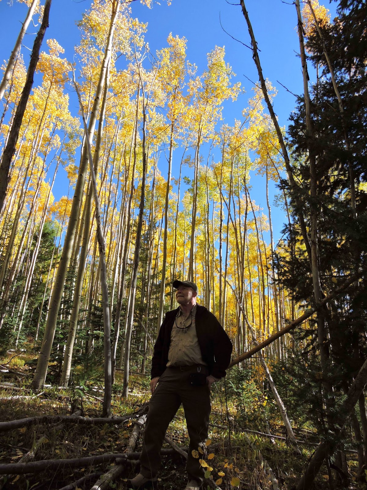
The Aspen Vista
Trail is one of the world’s largest aspen stands, a magnet for foliage watchers
like us. In the autumn months, the
glossy-green leaves of these tall, white-barked trees turn a golden shade of
yellow. The color blankets the side of
the mountain. As we ascended higher into the pine ridge, the Rio Grande
Valley’s fiery-yellow cottonwood trees also come into view.


We stopped at a popular campground with a well-marked trail to hike and admire the towering aspens and listen to the song of the falling leaves.


Here is a video our the babbling brook.


Being the explorers that we are, we hiked off the trail into unchartered territory!


The sound of leaves falling all around us was so peaceful, you just wanted to climb onto a hammock and fall asleep.
Here is a 360 degree video of the aspens.
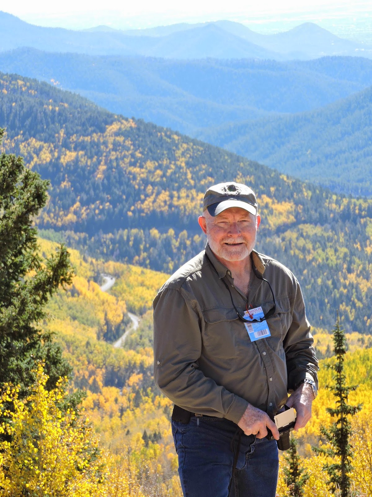
We continued our
drive toward the top of the mountain to the Santa Fe Ski Lift.

We rode the lift to the top of the mountain at 11,250 feet in elevation. It was cold and mountain man Mike didn’t wear his jacket! Sharon was warm in her rain jacket and fleece, hat and gloves! The ride on a ski lift was our first! Not being skiers, we could only imagine the thrill of jumping off the chair to ski down the hill.

Here is a video of the chair lift ride and view.
We rode the lift to the top of the mountain at 11,250 feet in elevation. It was cold and mountain man Mike didn’t wear his jacket! Sharon was warm in her rain jacket and fleece, hat and gloves! The ride on a ski lift was our first! Not being skiers, we could only imagine the thrill of jumping off the chair to ski down the hill.
Here is a video of the chair lift ride and view.


Along our ride up we noticed trees decorated with strands of beads, perhaps a tradition among skiers to throw them from their chairs! Had we only known!

As we approached the end of the ride, we were told to lift our legs and raise the bar and jump off!


The view from the mountain top was awesome while the birds sang and posed for photos! The view of the winding road up the mountain looked so small from where we now stood. The lush green pine trees and golden colors surrounded us. The sky was a crisp blue. It was a place to stay awhile and absorb its unspoiled beauty and solitude, at least at this time of year. In the winter, it must be buzzing with activity!


The ride down gave us another perspective and was just as beautiful. We hated to give up our fix for the autumn foliage! But all good things must come to an end!


Jemez East Fork Trail
We had a little
over a week left in Santa Fe, so for our last outing we returned to the Jemez
Mountains on October 3 to hike the East Fork Trail. We learned about this trail from a hiker we met on a previous hike (Tent Rocks). He said it was a little known trail that not many people know about, so we had to check it out!


 Our readers may remember the Santa Fe Blog #2 describing
the Valles Caldera National
Preserve. One million years ago a
volcanic eruption in the Jemez Mountains created the 13.7 mile Valles Caldera,
one of seven super volcanoes found in the world. When the volcano erupted, approximately 95
cubic miles of high viscosity molten rock (magma) was blasted into the
stratosphere and onto the surrounding landscape. The explosive power launched house-size
boulders, some of which landed miles away onto the East Fork Trail that we were
hiking on. Ash from the Valles caldera
explosion was carried by winds as far away as central Utah and eastern Kansas,
and was rafted by the Rio Grande as far south as El Paso.
Our readers may remember the Santa Fe Blog #2 describing
the Valles Caldera National
Preserve. One million years ago a
volcanic eruption in the Jemez Mountains created the 13.7 mile Valles Caldera,
one of seven super volcanoes found in the world. When the volcano erupted, approximately 95
cubic miles of high viscosity molten rock (magma) was blasted into the
stratosphere and onto the surrounding landscape. The explosive power launched house-size
boulders, some of which landed miles away onto the East Fork Trail that we were
hiking on. Ash from the Valles caldera
explosion was carried by winds as far away as central Utah and eastern Kansas,
and was rafted by the Rio Grande as far south as El Paso.


It was a full day of hiking and resting, taking photos and looking for bears! We took a seat on a fallen log and pulled out our energy bars for a quick snack.

After we regained our energy at McCauley’s Warm Spring,
we began our descent back down the mountain to the canyon below. Sharon did not
want to be in the forest in the dark, so it was a brisk hike and easier to go
downhill! Although when we came to the trailhead, we were surprised to see hikers
on their way in at near dusk! It was a
great day!
Stay tuned for Part 6, the last of our Santa Fe
adventures!
Mike & Sharon
“It is good to have an end to journey toward; but it is the
journey that matters, in the end.”
Ursula K. Le Guin